
Conquering the Canning Stock Route with Telematics

After 10 years away from motorbiking, the call of adventure with some friends led Brendon Nazar, Regional Sales Manager, Fleet Complete, back into the saddle for an ambitious journey — tackling the legendary Canning Stock Route.
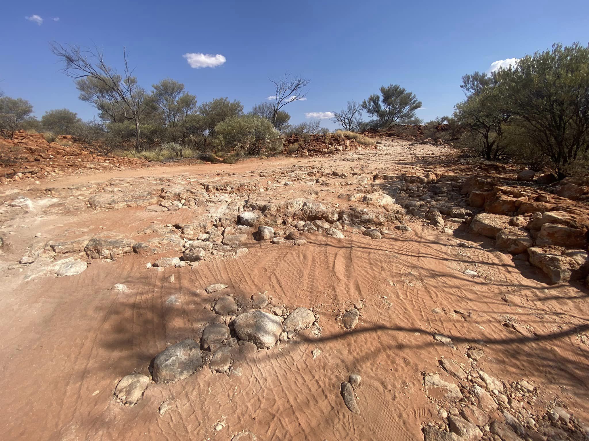
This remote 1,800-kilometre trail cuts through the heart of Australia and has no phone coverage, fuel stations, or even shops.
For Nazar, the journey from Wiluna through to Halls Creek wasn't just a test of physical and mental stamina — it was also a deep dive into the rugged beauty of this historical route, and a trial by fire for his and his team’s equipment.
.jpg)
Preparing for one of Australia’s most rugged routes
Having worked for a decade at Fleet Complete, a telematics business based in Australia, Nazar had access to everything he needed to keep track of his team’s progress and put the systems through the ultimate test. There are few rougher roads in Australia.
Planning for the trip alone took a year, as they had to identify all the automobile spare parts they needed to pack, but he notes that was easier than emotionally preparing their families.
They knew that the full journey would not be without breakdowns, since they would have to travel across boiling soft sand and climb over hard rocks. The route ended up having one of the worst corrugations that he’s seen in his life, and they even bent an axle on a trailer.
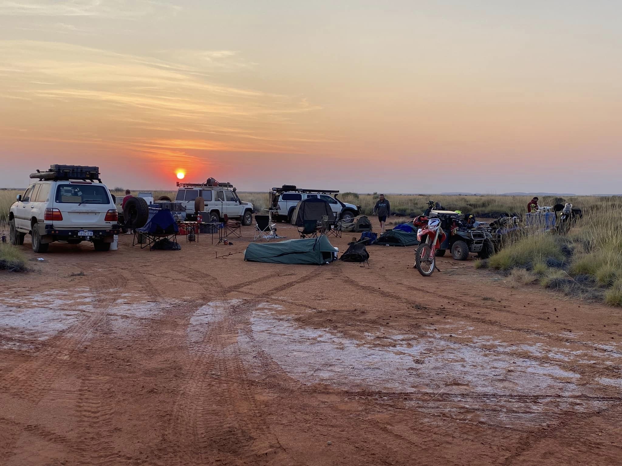
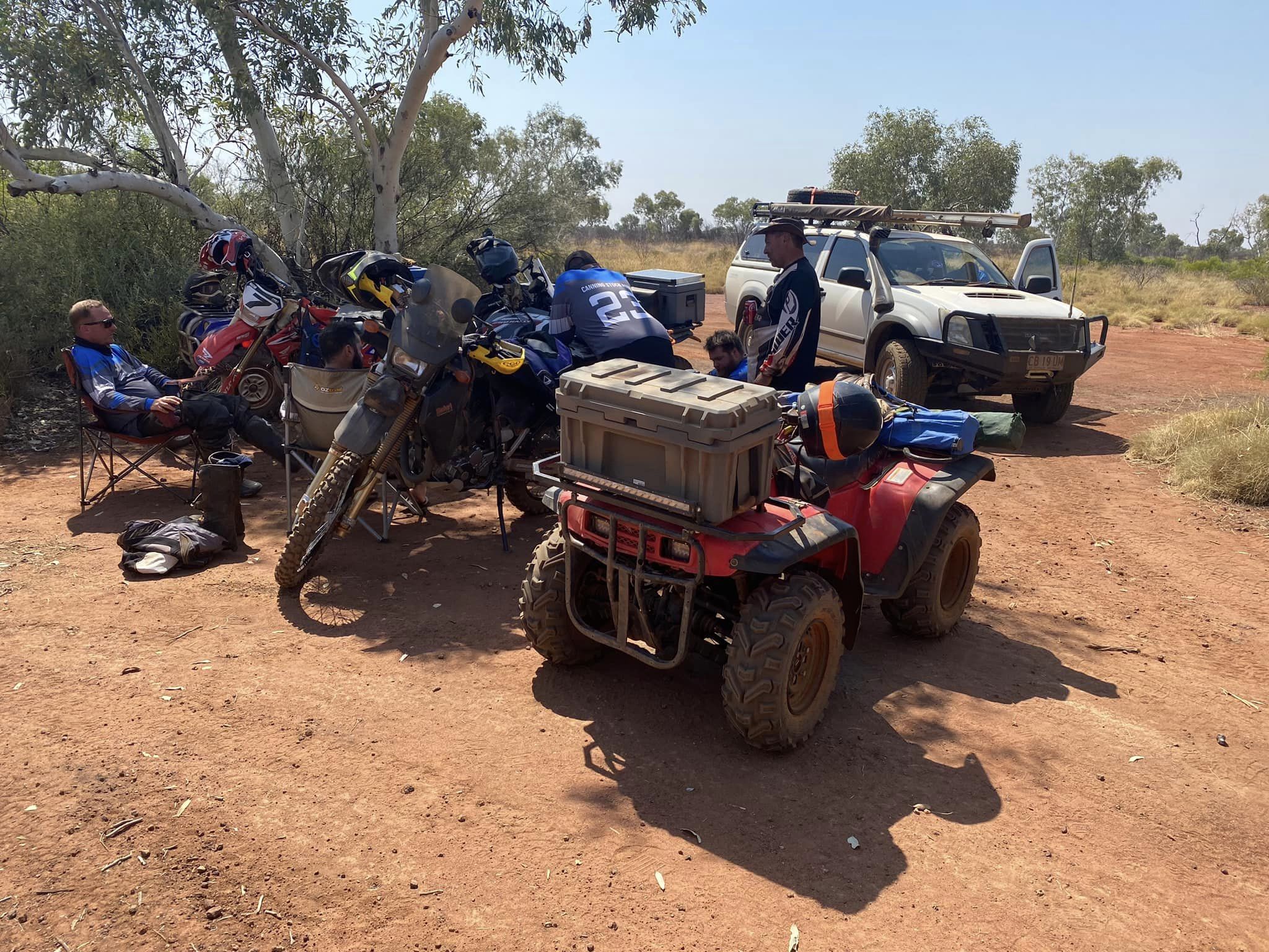
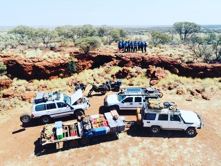
They embarked on this adventure with a fleet of close to ten four-wheelers, motorbikes, and support vehicles. Being well-prepared was key, so they also took along 3.5 tons of fuel, food, water, welders, and generators.
Staying in close touch without satellite phones
He says that, although it was refreshing to be free from the constant pull of technology, they wanted a way to let their families know that they were safe along the way.
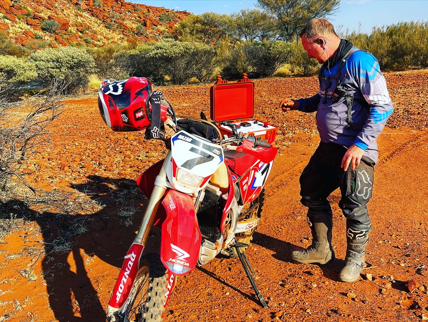
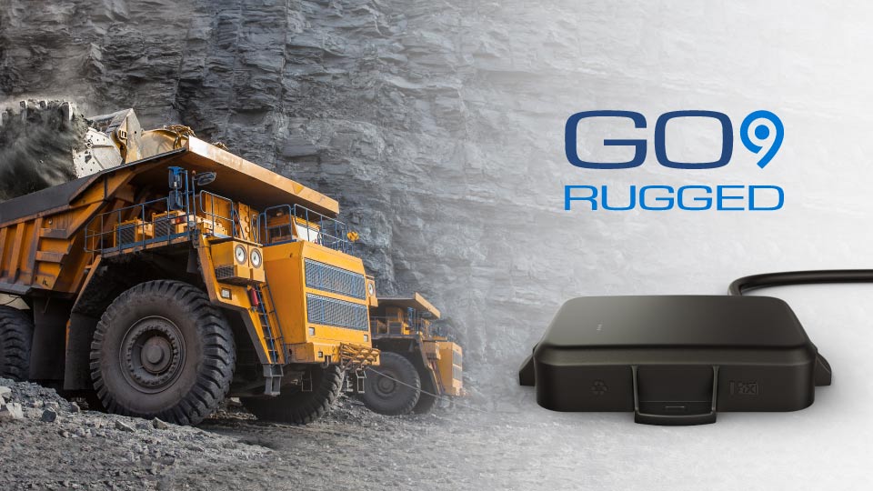
Before the journey, he fitted a telematics system — the Geotab GO9 RUGGED — to his bike. Designed for the harshest conditions imaginable, this compact technology became their lifeline during the 13-day trip as it offered them a way to stay connected without the encumbrance of satellite phones.
With the device installed, the team’s families were able to track their day-to-day progress and ensure their safety from afar. By accessing a secure link, Nazar’s father-in-law was able to monitor their adventure vicariously — he even got to learn about the history of the track as he followed them virtually. Their families were able to see where they stopped and for how long.
Solely through the system, Nazar’s family was aware that the team had a breakdown after noticing they had stopped for five hours during the day, outside of their normal trip. This also happened when the team lost the axle to one of the trailers and stopped for four hours — the family was able to tell that something had gone wrong.
Duress button as a safety signal
Nazar triggered the duress button on designated days and times to inform family and friends that the team was safe. They had an understanding that if he triggered it outside the fixed time periods, or if he never pressed that button at all, it meant that they needed help.
In case of an emergency, they could easily press the button to alert their families. This was a safety net that brought reassurance to everyone involved, as Geotab’s system allowed for immediate alerts in critical situations — a feature that proved its worth in the vast emptiness of the Australian outback.
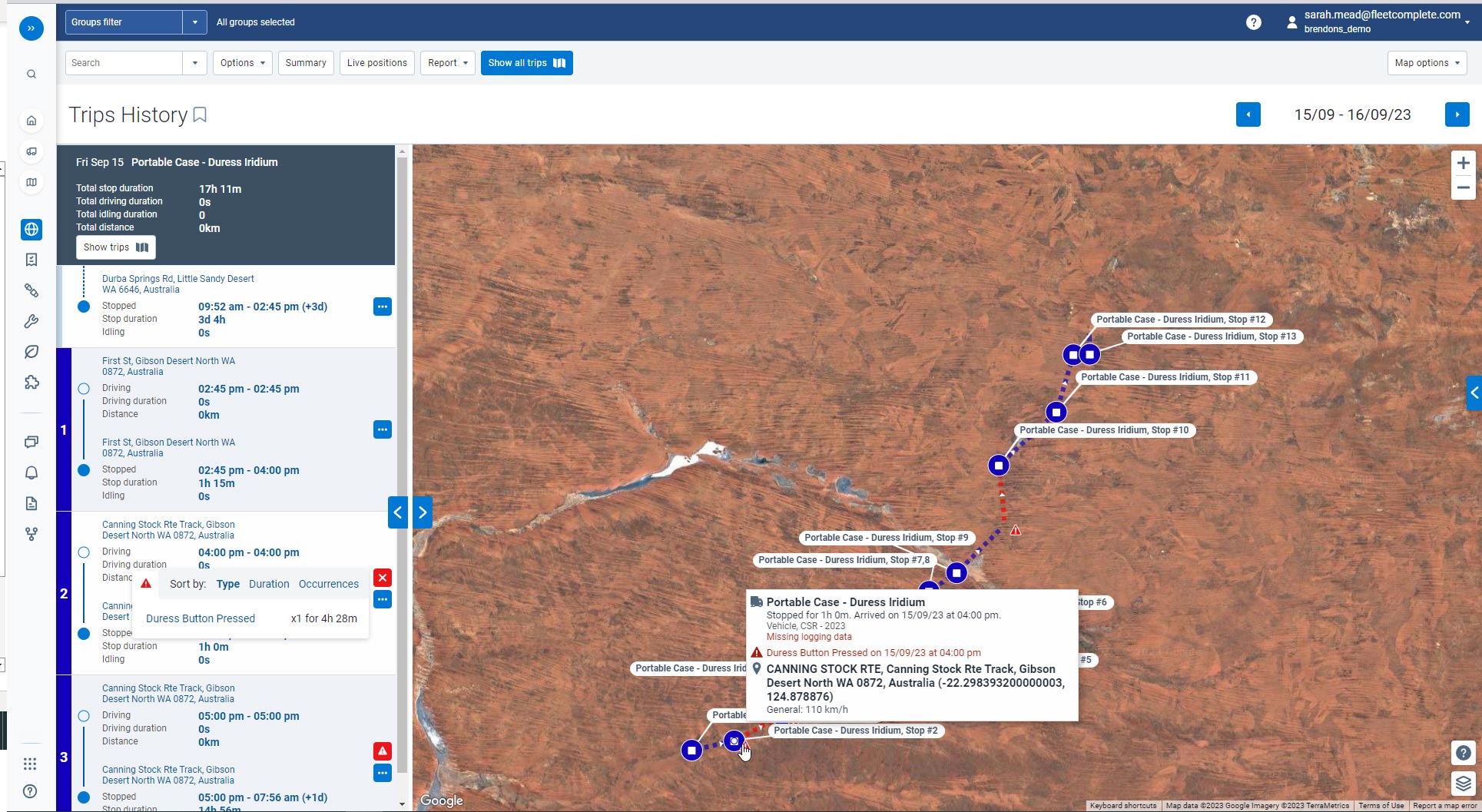
On top of the telematics on Nazar’s bike, one of their support vehicles carried a portable case which was plugged into a cigarette lighter for satellite coverage using Geotab’s data subscription plan. Even today, Nazar can still access his troop history on Geotab’s platform, which is very useful to show the remoteness and the lack of data of the route.
Suffice to say, the device was subjected to conditions as harsh as any work site or remote exploration might offer. Very little care was given to the duress box, as they left it in the footwell of the car.
The trip of a lifetime, but also the first of many
Surviving the Canning Stock Route meant overcoming mechanical failures, navigational challenges, and the physical toll of long days in the saddle. Every breakdown, the corrugated roads, and the endless dust tested the team’s resolve and resourcefulness.
Their equipment was pushed to the limit, yet through it all it remained reliable and functional. Nazar’s team spent a total of 21 days away from home, of which 13 days were spent conquering the track. Looking back, he says it was a transformative experience.
As he and his friends plan their next adventure into the Gibson Desert, the lessons learned and the confidence gained from their time on the Canning Stock Route will guide them. The GO9 Rugged, having withstood one of the toughest tests on the planet, will undoubtedly be part of their gear, ensuring safety and connectivity no matter where the trail leads.
The Geotab Team write about company news.
Related posts
.jpeg)
Geotab becomes a certified Telematics Monitoring Application Service Provider
April 1, 2025
3 minute read
From Rebates to Road Safety: A Guide to Optimising Your Council Fleet
March 24, 2025
1 minute read
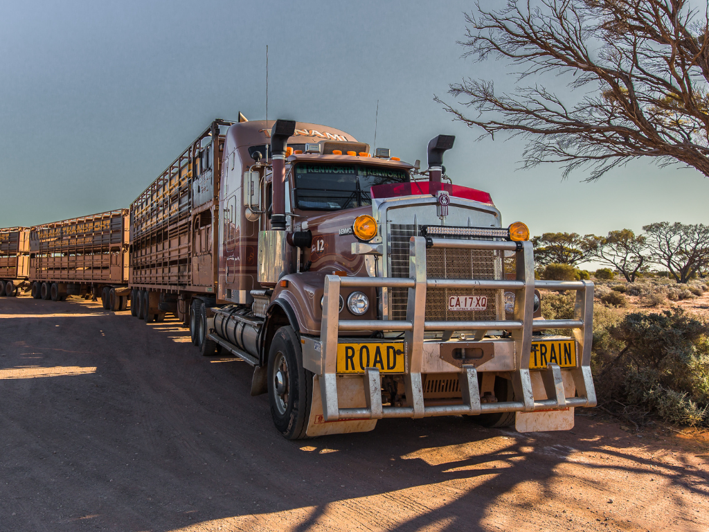
From Horse-Drawn Carts to High-Tech Haulers: The Evolution of the Trucking Industry in Australia
March 21, 2025
3 minute read
Sustainability Centre: central hub for sustainable fleet management
January 28, 2025
2 minute read