Emergency services
Keep your community safe with advanced police fleet management software and analytics.
Police fleet management software features
Leverage police fleet’s data for operational insight based on actual movements
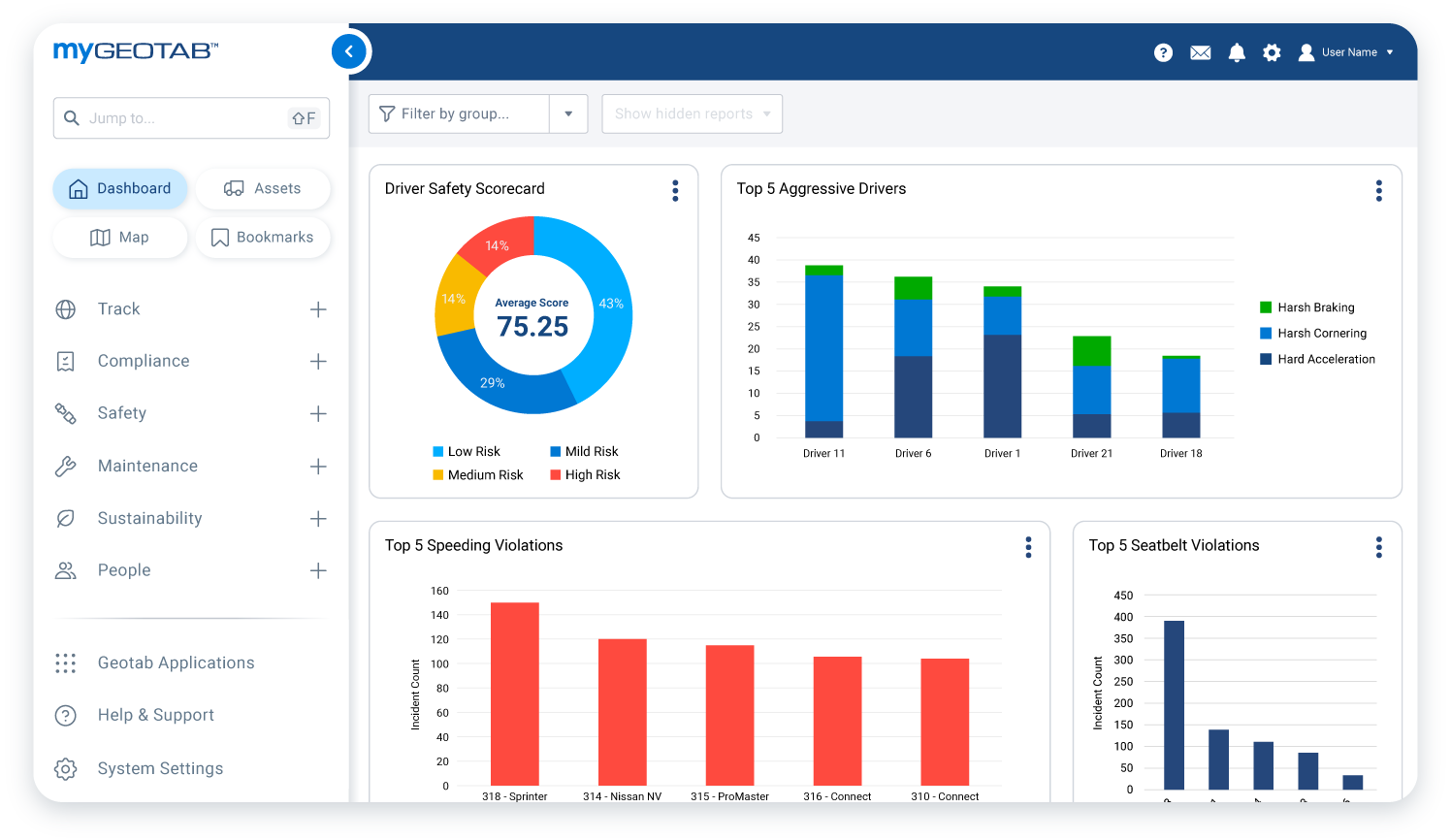
Manage driver and public safety with behaviour reporting and coaching
Plan efficient routes to avoid congestion, cut costs and go green
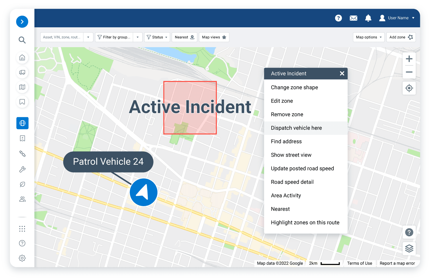
Monitor police fleets in the field to improve dispatching times


Go further with big data
Ensure responders get there safely with driver behaviour monitoring
When not attending to emergencies, your police fleet vehicles are driving alongside normal vehicles in regular traffic conditions. This means monitoring speeding, harsh braking, and seat belt use are vital for fleet and public safety. Monitor these metrics to set a good example for the communities you support. Integrate with lights and sirens and set custom rules to ignore speeding alerts when your team jumps into action.


Why use Geotab’s police fleet management software?
- Predict maintenance needs before they cause a breakdown
- Monitor your fleet in action with live GPS tracking
- Integrate vehicle functions and analyse data to target response efficiency
- Monitor safe driving behaviours and set overrides when vehicles are responding to emergencies
- Plan patrols and reduce idling to save on fuel costs

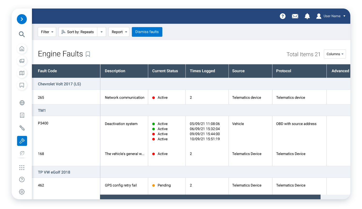
Predict technical faults before they occur to keep your fleet available at all times
When even one vehicle is off the road for unscheduled repairs, it reduces your capacity to provide life saving services. With Geotab’s capability to pull engine data and fault codes, you can plan fleet maintenance efforts targeted to the vehicles that need it most and help keep your fleet ready for duty.
Plan efficient patrols to reduce expenses

Emergency services fleet solutions from Geotab Marketplace
Maintenance and diagnostics
IOX, adapters and harness
Fleet management and TMS
Commonly asked questions about emergency fleets
Which emergency services vehicles does Geotab work with?
Geotab works with different energy service providers and their vehicles around the world. We support police, fire, ambulance and more. To learn more about Geotab’s police fleet management software, Request a Demo today.
How can telematics technology help improve police and emergency responder fleet management?
How can police fleet management improve driver safety?
What is federal police fleet management?
When your fleet of police vehicles is not actively responding to emergencies, they are driving in ordinary traffic alongside other cars. This means that keeping an eye on speeding, harsh braking and the use of seat belts is critical for fleet and public safety. To set a positive example for the communities your police unit assists, it’s important to monitor these behaviours. Set custom rules to disregard speeding alerts when integrated light-bars and sirens are activated.
What are the advantages of using a tracker for a police or first response fleet?
Geotab GO devices and the MyGeotab platform can help police (or other first responder) vehicle dispatchers to identify the closest vehicle to a trauma or crime scene for the fastest possible response time.
Emergency services dispatchers need situational awareness to better allocate resources and protect drivers. With Geotab, emergency service resources can coordinate and communicate with each other quickly and easily, using accurate, near real-time data. Whether at the municipal, state or federal level, the integration of telematics data can be pivotal for the office of emergency response and boost the collaboration between first responders on duty.
Collisions and vehicles rendered inactive can be detected instantly. As such, additional personnel can be sent to assist an officer, EMT, or fire rescue team that needs assistance. Vehicle maintenance requirements can help many first responder teams to minimize their fleet vehicle down-time by identifying maintenance requirements and diagnosing minor mechanical issues before they become serious problems.
Can a GPS tracker be used in police vehicles?
Yes, Geotab GO devices can be installed in police vehicles, synced with a GPS device, and used for all of the services the police department has subscribed to. The GO device can be connected to monitor light bars, sirens and gun racks with IOX expansion.
