Building a proactive government fleet safety program with data and AI
Slash risk and save taxpayer funds. Learn how data and AI tools can help you build a proactive, liability-reducing government fleet safety program.

Mar 9, 2026

Key Insights
- Proactive government fleet safety is key for reducing collision risk and liability, especially with nuclear verdicts being up 400% since 2013.
- Driver scorecards are where many fleets start, but a safety strategy built on data alone leaves your agency unaware of its true collision risk.
- From video telematics to benchmarking, AI-enabled fleet safety tools can help you unlock deeper insights to proactively shield your agency from liability.
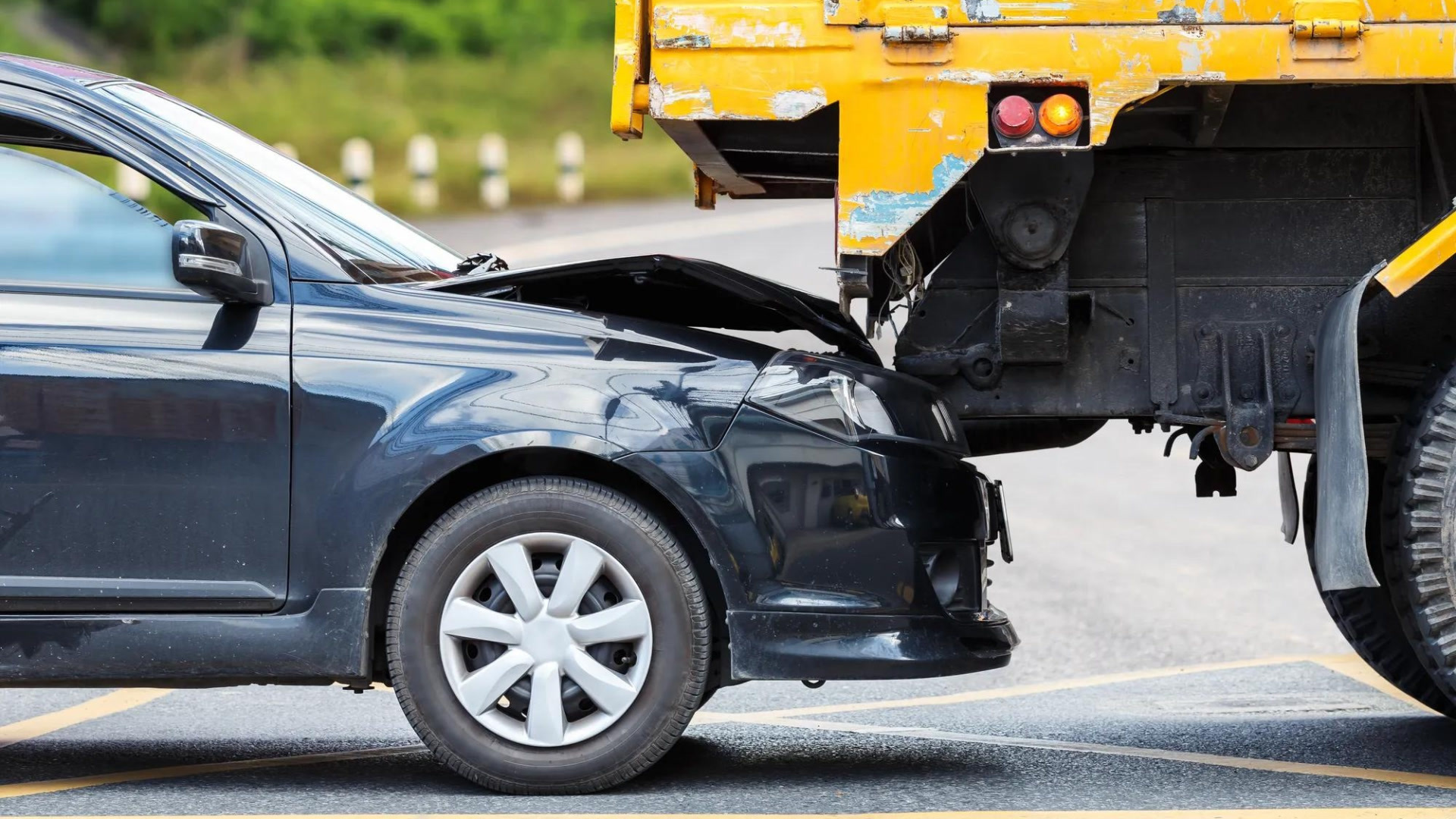
Collisions put more than just the safety of your people and the public at stake. With nuclear verdicts climbing by 400% since 2013, the financial threat that liability also poses to your agency is growing. And if your government fleet safety program isn’t currently integrating AI with data insights, risks like these could be even more likely. This is because a program that only uses data helps you see your drivers’ past behaviors, but it doesn’t extend to where you could be most exposed to future risk. As the saying goes: “You can’t make forward progress by only peering in the rearview mirror.”
To protect your budget, reputation and people, it’s critical to transition from a reactive to a proactive government fleet safety program. In this post, we’ll show you how to make the switch with data and AI-enabled tools.
Driver scorecards: A stepping stone for your government fleet safety program
How are my drivers currently driving? Many fleets choose to answer this question first — often with the help of datasets like driver scorecards. This is because scorecards are tailored by fleet, rooted in performance and easily recognized by drivers. To accurately assess each team member’s behavior behind the wheel, these metrics factor in events like:
- Harsh acceleration.
- Abrupt braking.
- Speeding.
- Seat belt usage.
Although driver scorecards are better indicators of past on-road performance than real collision risk, you can use them in your own fleet to start making baseline safety improvements. For example, the Missouri Department of Transportation weaved scorecard insights from Geotab into their driver coaching strategies, helping them achieve:
- A 20% increase in driver safety scores.
- A 25% decrease in the number of fleet liability claims.
- Over $1 million in liability claims savings.
- A 100% reduction in 15+ mph speeding events.
But despite scorecards’ value, coaching based on past insights alone is becoming insufficient. In response to rising nuclear verdicts, many agencies are searching for tools that help them forecast risk and get ahead of incidents. To similarly evolve your liability defense, your natural next step is to use the power of prediction.
Forecast future risk with predictive collision insights
To build a proactive liability defense, predictive technologies like Geotab’s Collision Risk are available. This tool helps you reduce incident chances by using AI to forecast your fleet’s probability of a collision over its next 100,000 miles. It accounts for unique factors like:
- Previous driver behaviors.
- Vehicle purposes and usage rates.
- Types of vehicles and their weights.
- Environmental elements (such as average precipitation rates).
- Route disruptions, like construction work.
As a powerful additive to baseline driver data, Collision Risk gives your agency a true North Star to follow for fewer incidents. But make sure to always measure the results of new safety strategies over time by comparing your predicted collision rate against your actual rate. With consistent monitoring, you’ll help your agency stay forward-focused and close the gap on risk.
Unlock deeper context with safety benchmarking
While knowing your fleet’s collision probability is important, it’s limiting without context. Safety benchmarking can provide you with a critical reference point. It allows you to compare your agency’s safety metrics against anonymized insights from fleets of similar sizes and vehicle types, helping you pinpoint:
- Which safety categories you’re excelling in.
- Where you might be falling behind.
- What you can do to catch up.
For example, Geotab’s Safety Benchmarking tool allows you to see how your fleet stacks up against others with a proprietary AI model that groups like fleets together. Study average and best-in-class collision risk scores from similar fleets to set smarter safety goals for your agency.
Stay proactive with AI video telematics
Measuring overall collision risk is just one part of the risk management equation. To help your drivers avoid hazards before they cause costly liability incidents, AI dash cameras are another important tool to consider adding to your safety program. These devices are able to detect and flag risks that could lead to collisions in real time, helping your team stay safer and limit liability.
However, since your agency’s fleet isn’t one-size-fits-all, your cameras shouldn’t be either. Whether you’re in a strict union environment or require more robust solutions, here’s what you need to know about dash cams for government fleets.
Road-facing AI dash cams: Ideal for privacy-conscious agencies
If your agency must comply with driver privacy concerns, road-facing AI cameras are your best fit because they don’t record in-cabin behavior. A top-tier road-facing camera solution should be able to help your agency:
- Proactively lower risk - Identify fleetwide safety issues, predict risks and offer targeted driver coaching with accurate, AI-generated insights.
- Cut liability costs - Automatically capture video of collision events and review the footage to exonerate drivers (or expedite settlements).
- Keep data secure - Protect driver privacy with a camera solution that encrypts data, locally processes it and exclusively records key driving events. For instance, Geotab’s GO Focus uses AI vision to sense and only capture road events like tailgating, lane departures and collisions.
Dual-facing AI dash cams: Perfect for agencies with more flexibility
If your agency has greater latitude, take fleet safety even further with dual-facing AI dash cams. These solutions monitor what’s going on in the cabin and on the road, with best-in-breed options able to help you:
- Enhance driver vigilance - Keep drivers focused with real-time alerts that help them improve in the moment, not hours later. For example, Geotab’s GO Focus Plus uses AI to deliver instant, in-cab feedback to drivers the moment it detects risky behaviours like distracted driving, tailgating, seatbelt violations and lane drift. The coaching workflow surfaces the most critical events and repeated patterns first and turns alerts into individualized coaching opportunities, letting you follow up, track progress and recognize safe driving in one seamless platform.
- Prevent collisions - Help drivers stay ahead of risk with leading AI models that accurately discern objects, predict movements, estimate distances and identify lane boundaries.
- Improve pattern recognition - Get deeper insights by identifying compound risks, causation between risky events and which drivers are responding to coaching.
With almost 50% of at-fault collisions stemming from 25% of your riskiest drivers, proactivity is key for prevention. Reduce incident chances with camera solutions that help your drivers get (and stay) ahead of risk.
Respond to collisions faster and reconstruct them with data
While dash cameras and predictive insights do help you reduce collision likelihood, incidents are still possible. If one of your vehicles is involved in a collision, how long does it take you to find out about it? The quicker you know, the faster you can respond.
Features like collision detection can promptly notify you of an incident via an SMS message or email, using AI to detect and classify collision patterns by severity. Immediate severity context helps you determine if a tow or ambulance is needed, guiding a proper response plan.
And while not AI-enabled, tools like collision reconstruction can also help you understand an incident’s cause with speed and impact point insights. By rebuilding collisions with data, this capability helps you coach your team on avoiding similar incidents in the future, clear innocent drivers and retain valuable evidence for insurance disputes.
Unify your tools for proactive government fleet safety
Amid soaring nuclear verdicts, every mile your team drives carries risk. But by using data and AI to unearth deeper safety insights, you’ll be able to build a strategy that doesn’t just react to collisions, but actively helps you look ahead to prevent them. From driver scorecards to AI video telematics and benchmarking, Geotab can connect all your safety tools in one solution for a complete picture of current (and future) risk. Use this unified view to build a proactive safety strategy that brings employees home each day, protects your agency’s budget and drives greater public confidence.
Protect your agency against liability with a complete, contextualized view of your fleet: Download our ebook to learn more.
Subscribe to get industry tips and insights
Frequently Asked Questions
A government fleet safety program is an organized network of policies and tools that helps agencies protect their drivers and other motorists on the road. Government fleet solutions are key for helping agencies uphold their safety programs, as they allow them to identify and correct dangerous driving habits, measure collision risk and highlight improvements.
AI in fleet management elevates driver safety by helping fleet managers actively predict risk, not simply react to past events. Here are several examples how:
- Calculating your fleet’s collision probability over its next 100,000 kilometers or miles.
- Determining a collision’s severity level, so you can appropriately respond.
- Helping you compare your fleet’s safety metrics against those from similar anonymized fleets.
- Catching and correcting risky driving habits like drinking, texting or lane swerving in real-time.
Government fleet solutions can also help organizations improve:
- Fuel efficiency - Track and reduce habits that burn unnecessary fuel, such as idling, speeding and harsh acceleration.
- Vehicle health - Prolong vehicle lifespans and optimize maintenance costs by using data insights to make smarter servicing decisions.
- Vehicle utilization - Prevent uneven vehicle wear by using odometer readings and engine hours data to spot imbalances and equalize usage.
- Sustainability - Monitor carbon emissions to identify the highest-emitting vehicles and replace them with electric alternatives.
Content Marketing Manager at Geotab
Table of Contents
- Driver scorecards: A stepping stone for your government fleet safety program
- Forecast future risk with predictive collision insights
- Unlock deeper context with safety benchmarking
- Stay proactive with AI video telematics
- Respond to collisions faster and reconstruct them with data
- Unify your tools for proactive government fleet safety
Subscribe to get industry tips and insights
Related posts

Beyond the hype: Real AI priorities for field service leaders
March 26, 2026
6 minute read
Unified data: The key to fleet liability reduction for government agencies
March 19, 2026
9 minute read


The Simple Truth: Why Rewarding Safe Driving is Your Fleet’s Smartest Business Decision
February 25, 2026
4 minute read

Building resilient school bus operations through four student transportation trends
February 24, 2026
6 minute read