Preventing collisions with the power of prediction
Learn how Geotab’s Safety Center integrates collision detection and predictive analytics to improve fleet safety, cut costs and shift your strategy from reactive to proactive.

Content Marketing Manager • Corporate Marketing
Nov 15, 2024

Your fleet safety program is a promise to your team, a commitment to your customers, a duty to your community and a protection for your assets. Every collision, no matter how minor, has far-reaching consequences—disrupting operations, straining finances and endangering lives. The costs of vehicle repairs, increased insurance premiums and operational disruptions can quickly add up, placing a heavy burden on company resources. But what if you could shift your focus from reacting to incidents to proactively preventing them?
The hidden costs of fleet collisions
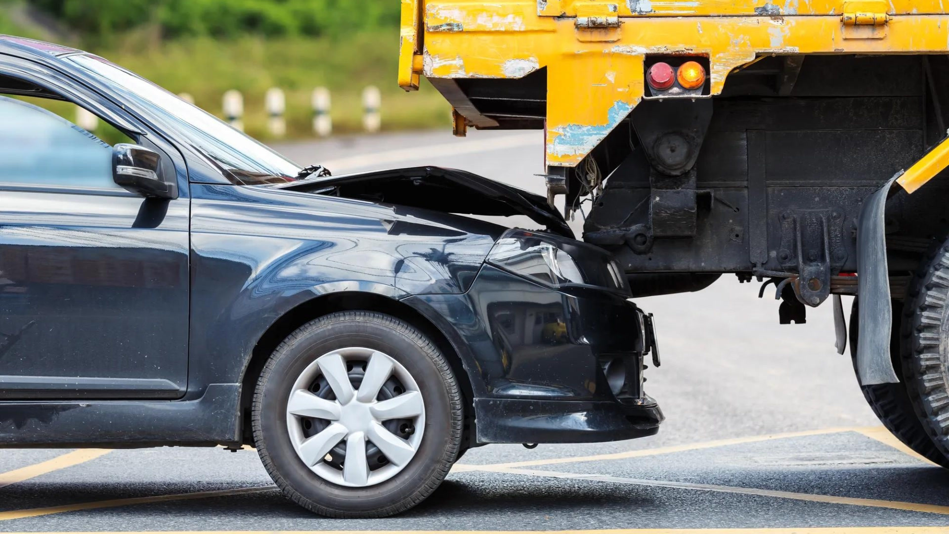
Fleet collisions are disruptive and costly on multiple levels. Financially, businesses face direct costs like vehicle damage, repairs and in severe cases, total replacements. A single collision can range from $16,000 to $75,000, even if it's minor and no injuries occur. Each incident can lead to operational delays, missed deliveries and customer complaints, damaging a company's reputation and eroding customer trust.
The human costs are even more profound. When a worker is injured, operations are disrupted, and the cost of workers' compensation claims can soar. Beyond the financial aspect, there's an emotional toll on employees and their families, leading to stress, anxiety and a drop in team morale and productivity. A poor safety record also affects insurance premiums and can lead to serious legal liabilities, draining resources and making it difficult to attract and retain employees and customers. Prioritizing safety and using advanced collision detection technology helps businesses protect their most valuable assets: their people.
The importance of accurate collision tracking
For fleet managers aiming to reduce risks and respond quickly to incidents, the ability to track and monitor collisions is critical. Geotab’s collision detection technology provides visibility into both minor and major collisions, offering insights that are typically unavailable unless reported. With near real-time alerts, fleet managers can quickly gather important evidence that would otherwise be lost.
Accurate collision tracking captures detailed data on each incident, shedding light on the causes and enabling preventative measures such as driver training and route adjustments. By providing irrefutable evidence that can be cross-referenced with claims, businesses can be protected from fraudulent reports. Analyzing historical collision data allows managers to uncover patterns and identify high-risk areas for targeted interventions. Moving from a reactive to a proactive strategy empowers fleet managers to better manage risks and overall operations.
Geotab’s collision detection technology
Nearly 50% of at-fault collisions are caused by 25% of your fleet’s riskiest drivers. Fleets that regularly use Geotab’s safety features see an average 40% lower collision rate, creating safer roads and more efficient operations.
Geotab’s collision detection technology marks a new era in fleet safety. Powered by AI and machine learning, it provides near immediate notifications when a collision occurs, allowing fleet managers to act quickly to minimize business impact, gather necessary evidence and expedite the repair process. Using AI models to detect collisions with incredible accuracy, it sends detailed notifications with location, time and severity. The system detects and categorizes all collisions by impact forces - major and minor – for quick action and better resource allocation.
Why Geotab’s collision detection technology stands out
Fleet managers experience a range of benefits with Geotab’s technology:
- Near real-time collision alerts mean fleet managers can act promptly, reducing the impact of accidents and promoting driver safety. Notifications are invaluable when it comes to minimizing damage and coordinating faster responses.
- Precision AI detection is another standout feature. With AI and machine learning, the system accurately detects and categorizes collisions, distinguishing between minor (1.5-2.5 Gs) and major (2.5 Gs and above) incidents. The high level of accuracy helps managers respond appropriately to the severity of each collision.
- Operational efficiency improves through quick response times and detailed incident reports. Actionable insights from these reports, allow managers to make informed decisions that minimize fleet downtime. Promptly addressing issues keeps operations on point and improves service delivery.
- Economic benefits of Geotab’s collision detection expand across the business. Immediate notifications streamline the claims process to help reduce costs. While collision-related downtime and improving vehicle utilization contributes to a healthier bottom line.
- Scalability is a key feature of the system, capable of managing fleets of various sizes—from small operations to large enterprises with thousands of vehicles. This flexibility allows managers to maintain control and oversight, promoting consistent safety and operational standards regardless of fleet size.
Looking ahead with predictive collision risk
Traditional safety scorecards, while valuable, only provide partial visibility into your fleet and driver safety. They offer historical context and are an important part of the overall safety picture. However, relying solely on historical data leaves a blind spot. Understanding what just happened, what is happening now, and what could happen are all important parts of the safety equation.
Geotab’s Safety Center changes the game by integrating predictive risk analytics, real-time data and advanced collision detection technology. This combination offers a holistic view of fleet safety and includes several key features:
- Safety performance analytics – Access key metrics, including collision risk and overall benchmarking against similar fleets.
- Detailed collision reports – Obtain comprehensive data on each collision, including location, time, and severity, to reduce the claim cycle and minimize downtime.
- Digital twin benchmarking – Compare your fleet’s safety performance against similar fleets by key risk factors such as speeding, acceleration, braking, and cornering.
- Seamless integration – Integrate with popular BI and reporting tools like Microsoft Power BI and Tableau through Geotab Data Connector, making safety data easily accessible and actionable.
By leveraging predictive intelligence to identify where your greatest risks lie, you can anticipate and prevent collisions before they happen. In fact, customers who regularly use Geotab Risk Analytics tools show a noticeable drop in collision rates.
The Safety Center provides fleet managers with a centralized place to understand their fleet's performance to help them manage risks and achieve operational excellence more effectively.
Ready to upgrade your fleet safety program?
Using Geotab Safety Center's Risk Analytics tools can reduce vehicle collision rates. Just one visit to our Risk Analytics page can lower collision rates, with more interaction leading to greater safety.
Learn how Geotab’s collision detection technology can protect your drivers and assets. Visit our Safety Center to find out more.
Subscribe to get industry tips and insights
Content Marketing Manager • Corporate Marketing
.
Table of Contents
Subscribe to get industry tips and insights
Related posts
Unified data: The key to fleet liability reduction for government agencies
March 19, 2026
9 minute read


Building a proactive government fleet safety program with data and AI
March 9, 2026
5 minute read

Building a coaching culture: How to end the ‘gotcha’ game in your fleet
March 4, 2026
3 minute read


The Simple Truth: Why Rewarding Safe Driving is Your Fleet’s Smartest Business Decision
February 25, 2026
4 minute read