Citizen Insights: Building trust and transparency in public works
Want to build trust and transparency with your community? Geotab’s Citizen Insights can help.

Oct 18, 2024

What is Citizen Insights?
Geotab’s Citizen Insights solution is a public-facing tool that provides your citizens with up-to-date visibility into public-facing services, including road service status for snow plows and salt spreaders in your winter operations, recycling and waste collection vehicles and/or street sweepers. Able to be set up as a webpage with custom city logos and colors, or as a live map embedded on your existing website, this tool helps you maintain crystal clear communication with your public and enhance transparency into your public works activities. Vehicle locations are reported accurately and a delay can be added to prevent privacy and driver safety issues from occurring while you’re reporting operations to the public.
Citizen Insights is fully customizable and lets you tailor and manage the solution to perfectly match your needs. With various integration options, you can choose the approach that best suits your municipality's 511 systems and IT capabilities. In addition, you can keep your community in the loop with real-time updates, emergency notices and project progress news using the new Banner feature.
This article will demonstrate how the Citizen Insights solution is implemented as well as why it’s such a necessary tool for public works agencies to embed into their operations.
Why Citizen Insights is a crucial tool for public works agencies
Citizen Insights is critical because it builds an additional channel of communication between agencies and the public. By providing citizens with up-to-date information, you can help minimize disruptions to public life, raise public confidence in your services and enhance safety.
For example, the solution can be used to inform the public about the status of roads, helping them plan their daily activities and avoid areas where work is being done. This visibility fosters strong communication between constituents and government agencies, enhancing public trust and promoting safer driving choices. In addition, public works agencies that have implemented the solution have seen a drastic reduction in service calls and inquiries, allowing them to spend more time on their operations.
Helping individuals know which areas to avoid driving in while service is being performed increases safety by reducing the chance of them driving on impacted roads or those that are not yet cleared. During disaster recovery situations or winter events, as debris or snow is removed from a location and workers are in the process of remediation, citizens can know to avoid these areas. This gives your employees enough time and space to restore the area and also keeps residents away from potentially hazardous situations. Citizen Insights is also versatile enough to fit with your agency’s seasonal objectives, working year-round to build public trust and transparency. Reduce questions about service and make it easier for your support team to resolve complaints, no matter what time of year it is.
Citizen Insights in action: Clearing the way for winter success
D.C. Public Works faced the familiar challenge of keeping residents safe and informed during winter storms. Citizen Insights stepped in, offering the ability to provide the public with real-time road condition updates. Although the solution was initially met with resistance, Citizen Insights has become an indispensable part of their winter operations. Residents rely on the public-facing website to gain critical road status updates and to know when their streets will be plowed. Citizen Insights has not only proven beneficial to the public, it has additionally provided the council staffers with an easy to use tool to respond to residents during snow events and reduce call volumes to their call center. As a result, the fleet managers are afforded more time and their snow command unit stays on the same page as their operations branch.
To hear more about the District of Columbia’s success with Citizen Insights, watch our webinar, where Brendan Ford, GIS Specialist for D.C. Public Works discusses how his agency uses the solution to build community trust and accurately report route completion percentages.
A public works solution that extends across all service types
Using Geotab’s Citizen Insights solution to keep the public informed promotes accountability and reduces public uncertainty. Whether it’s used for salt spreading, snowplowing, street sweeping or waste removal, this solution is an essential component of effective and transparent public works operations.
Implementing Citizen Insights: A step-by-step guide
To start the process of implementing Citizen Insights, you will first need to have deployed the Geotab public works solution. Citizen Insights layers on top of a configured Geotab public works solution and pulls data from GO devices in each of your vehicles into the live view map. The Citizen Insights Admin add-in must also be layered onto the database and set it up with your partner or account advisor. The first step of implementation begins with Geospatial Reporting.
Geospatial Reporting
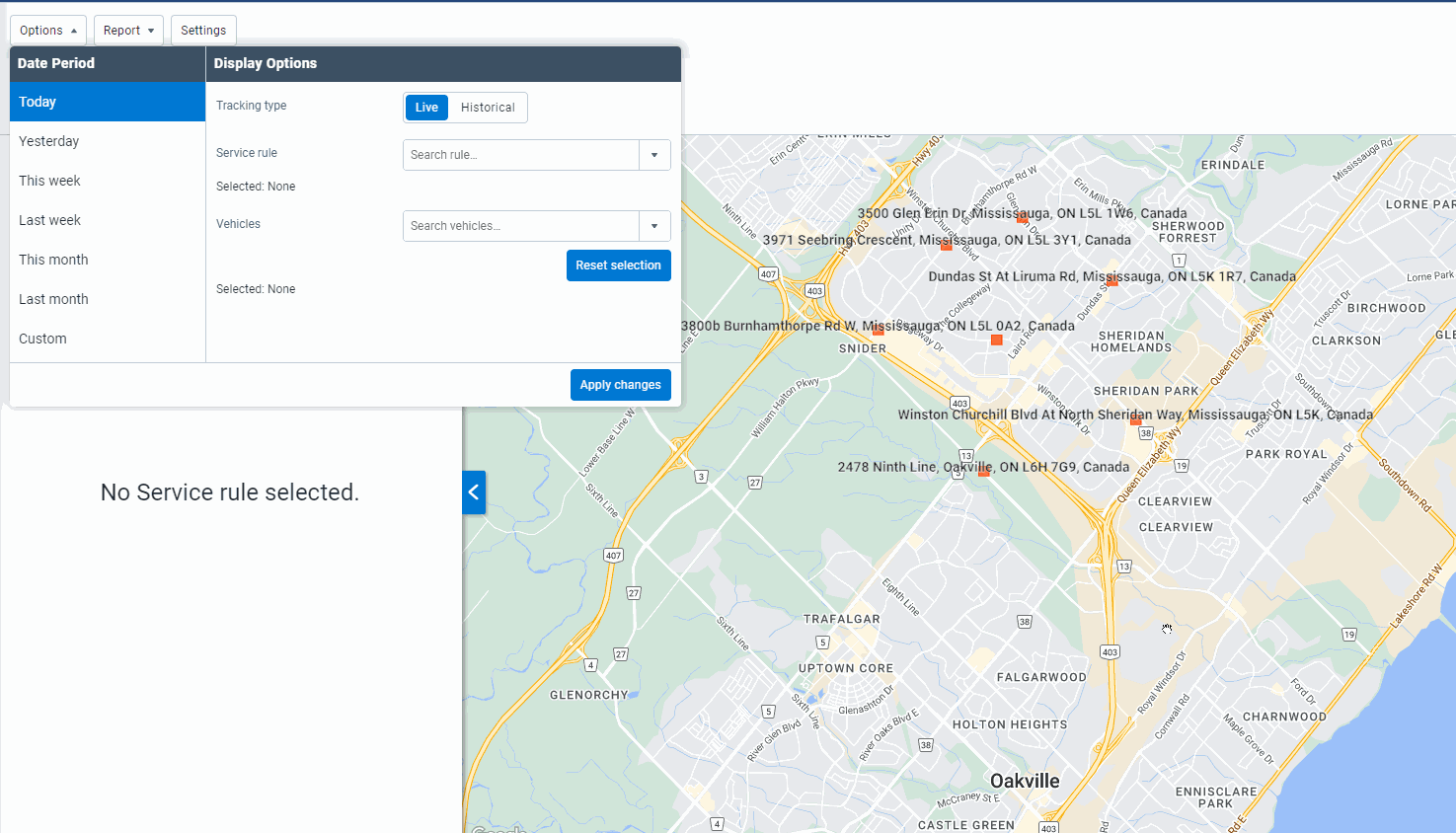
Geospatial Reporting within MyGeotab includes a variety of reports that cover specific use cases. The process of implementation remains largely the same, no matter the geospatial report: Route data is created using a GIS software and uploaded into the MyGeotab platform. This data is required to feed the insights eventually being shared with the public. MyGeotab uses the data uploaded and pairs it with GO device data to provide reporting that is first viewable to department leaders via Route Completion and Live Route Tracking. Both the route completion report and the live route progress map are easy to transition between, as demonstrated in the screenshots below.
An example of the Route Completion Report.
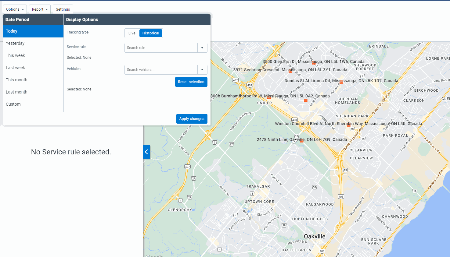
An example of live route progress being viewed within MyGeotab.
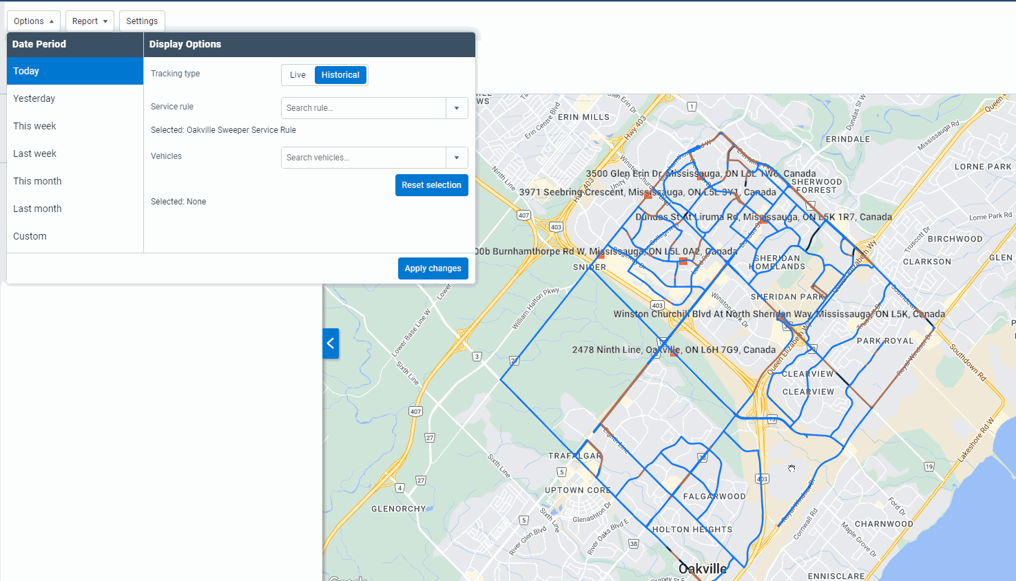
An example of transitioning from the Route Completion Report to the Live Route view.
Route configuration, requirements and the upload process
Departments are able to tailor specific information for public display after uploading route data to MyGeotab via a shapefile. A shapefile is a unit of storage that’s used to save and manage geospatial information. In the context of Citizen Insights, shapefiles contain route data needed to inform the public. Shapefiles must be created using a specialized GIS software outside of MyGeotab.
Want more details on Route Completion Configuration with a Shapefile? Check out our support documentation here.
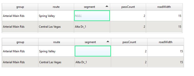
There are three primary requirements for shapefiles to be compatible with MyGeotab: Proper data attributes, geometry and coordinate systems. Starting with data attributes, the information needs to be free of null data points, potential duplicates and decimal-based road width values.
An example of an accurate attribute table:
Examples of incorrect attribute tables. NULL values, zero values for the roadWidth category or blank necessary attributes will result in a failed upload to MyGeotab. Any included integers also must be free of decimal points:
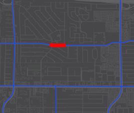
The next shapefile requirements involve route geometry. Accuracy of the reporting will be reduced if the road segments are overly lengthy. An ideal segment length is roughly 100 to 300 meters and shouldn’t overlap or intersect with other roads, as this could cause issues with the upload or result in erroneous reporting.
Examples of correct route geometry:
|  |
Examples of improper route geometry. Roads should be between 100 and 300 meters in length and must have unmistakable ending and starting points with no overlaps. Adjusting the lengths and route segments will help fix any route geometry issues:
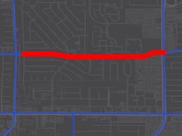
|  |
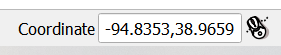
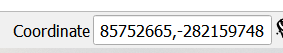
In addition to these requirements, WGS - 84 EPSG: 4326 must be set for the coordinate reference system (CRS) in order for the shapefile upload to work. Decimal points must also be in the proper spot, as coordinate values must fall within the -180.0 and 180.0 range.
An example of proper coordinate formatting:
An example of erroneous coordinate formatting. All routes uploaded to MyGeotab must use the WGS 84 - EPSG: 4326 coordinate reference system. Other versions of WGS 84 will not work, nor will a local CRS.
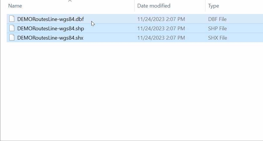
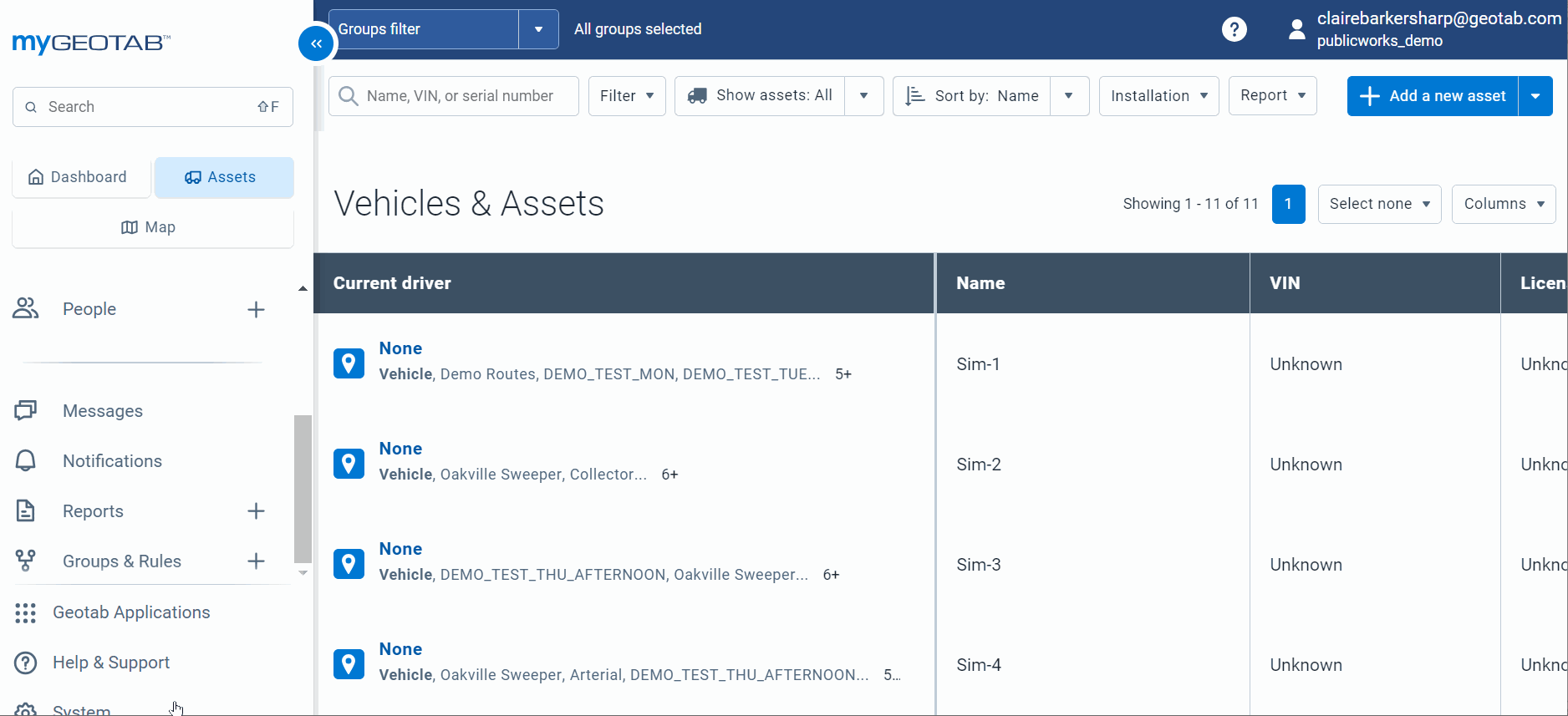
Once the shapefiles have been created, they can be uploaded to MyGeotab by compressing the data into a ZIP file, assigning vehicles, creating service groups and importing the ZIP file by bulk uploading routes.
Step 1: Compressing data files into a ZIP format:
Step 2: Uploading the shapefile:
Step 3: Bulk route import:
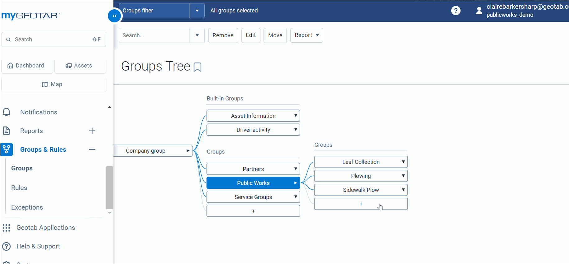
Within MyGeotab, a group tree structure exists where, after a shapefile is uploaded, segments and routes are categorized into groups. Additional groups can be customized to fit the needs of a public works organization and shapefiles are always uploaded to the parent group.
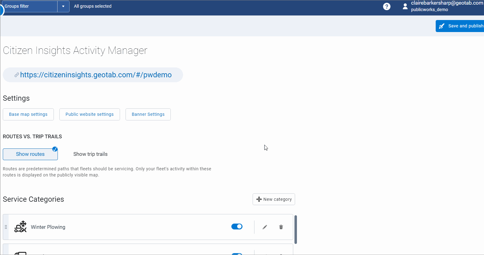
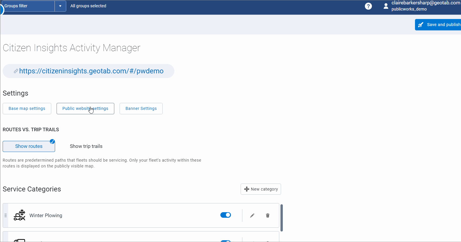
Admin configuration process
Through admin configuration, you can easily choose which information to share with the broader public. In addition to allowing users to add custom design elements and create a specialized URL, agencies can tailor what they share with citizens by adjusting message banners, service types displayed and road statuses. Citizens can then use this knowledge to avoid affected roadways and eliminate possible barriers to their daily activities.
Examples of the Citizen Insights Admin configuration process:
Still have additional questions about the Citizen Insights setup process? Check out our Citizen Insights User Guide page for more information.
Proceeding with the power of Citizen Insights
By implementing Citizen Insights, you can strengthen public trust and transparency with the media, your public and department leaders. Keeping everyone on the same page assures your constituents that your agency is doing everything it can to maintain safe, passable roads, all while reducing call volumes at your contact center. Connect your agency’s operations to your community and maintain total control over the information you want to share using this add-on tool to our public works solution.
Learn more about how Citizen Insights can save your organization money, free up additional time for your office staff and enhance public safety by requesting a live demo for yourself today.
Subscribe to get industry tips and insights
Content Marketing Manager at Geotab
Table of Contents
- What is Citizen Insights?
- Why Citizen Insights is a crucial tool for public works agencies
- Citizen Insights in action: Clearing the way for winter success
- A public works solution that extends across all service types
- Implementing Citizen Insights: A step-by-step guide
- Proceeding with the power of Citizen Insights
Subscribe to get industry tips and insights
Related posts

Unified data: The key to fleet liability reduction for government agencies
March 19, 2026
9 minute read


Building a proactive government fleet safety program with data and AI
March 9, 2026
5 minute read


The Simple Truth: Why Rewarding Safe Driving is Your Fleet’s Smartest Business Decision
February 25, 2026
4 minute read