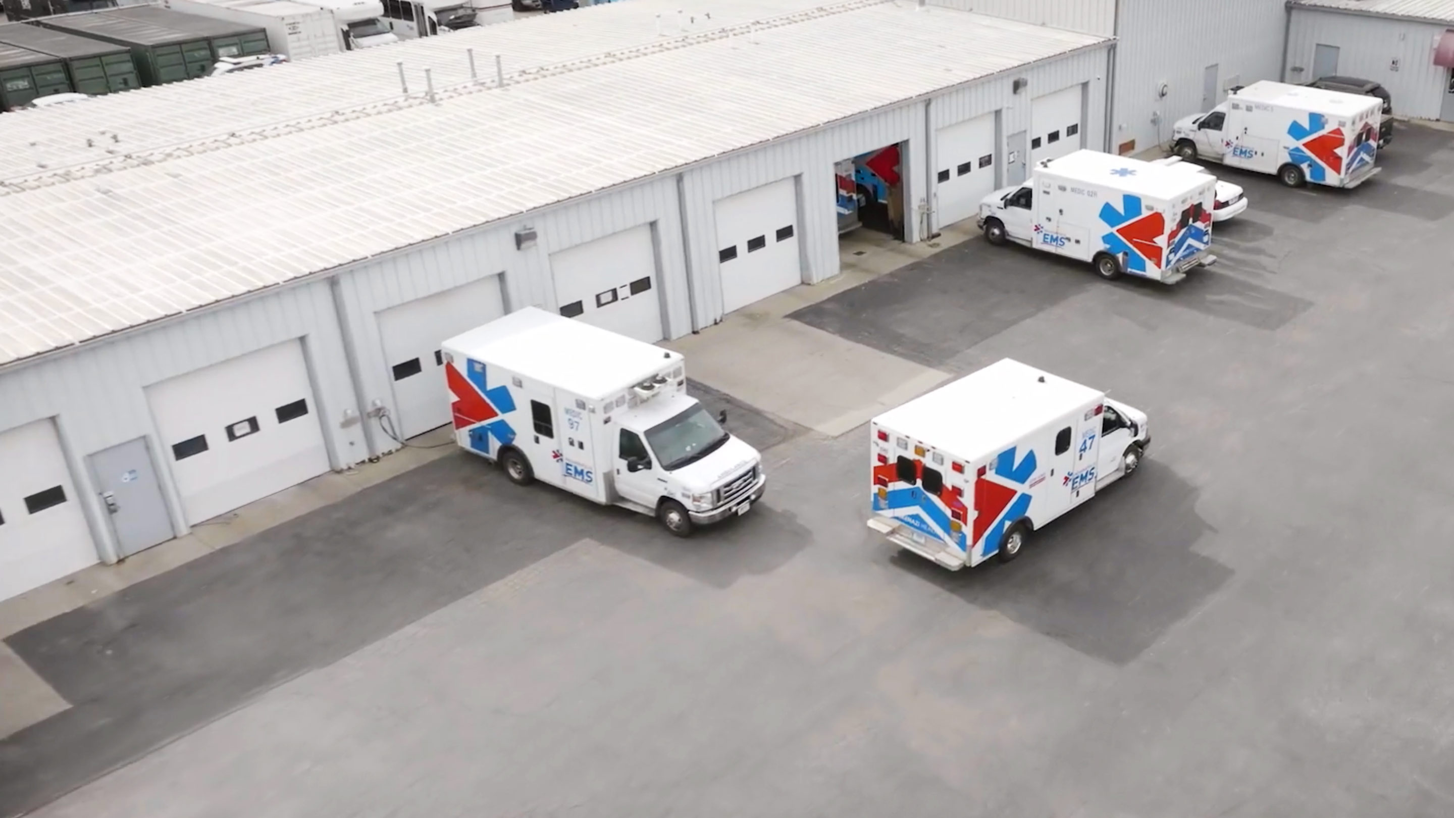
Indianapolis EMS: Serving the community while maintaining the fleet

Table of Contents
The Challenge: Optimizing maintenance and controlling fuel costs
Indianapolis EMS leadership realized that it needed a way to be as safe and efficient as possible in the wake of a fatal crash of one of its ambulances.
The solution was telematics. “In our desire to never have this happen again, never lose track of a crew, it was what spurred me initially to implement a telematics solution,” says Kevin Gona, Deputy Chief of Indianapolis EMS in charge of logistics.
Gona adds that the collision outlined the daily practical need for a robust telematics solution. “The realistic day-to-day concerns from telematics for us really revolved around the maintenance, fuel costs and wear and tear on the equipment of an ambulance fleet,” he says. “Ambulances are precious items in the vehicle world. They’re hard to come by. They’re very expensive and they are constantly used and worn. The better we can care for the ambulance, the better our crews feel about their jobs. It also helps us be more cost-effective and responsive with our resources.”
Focusing on controlling fuel costs and improving maintenance and uptime were seen as the two areas that would provide the fastest return on investment, according to Gona.
The Solution: The most consistently functional device
Gona says that he tried other devices, but the Geotab GO was the right fit for Indianapolis EMS for a number of reasons.
“The Geotab device, first of all, is very simple to install. It is a single plug into an OBD2 port,” he explains. “All of our vehicles are OBD2 port vehicles. We don't have a J bus. We tried other devices, and, honestly, the Geotab GO was the most consistently functional device. It had the best tracking data.”
Indianapolis EMS rolled out Geotab slowly across the fleet, first to a single vehicle, then to a half dozen or so, and then finally to the entire ambulance fleet. The solution proved to be a good fit from the beginning.
“We started with a single Geotab device, which both fortunately and unfortunately, produced immediate results in detecting some undesirable driving patterns,” Gona says, noting that as the solution was rolled out across the fleet, more actionable data was acquired.
Fleet maintenance staff now pull fault codes and have better insights into what is happening with the vehicle, optimizing uptime. The fleet team has also monitored idle time—one hour of which is considered 33 miles of driving. In both cases, the fleet team reminds the crews in non-punitive terms how to better use their equipment to keep it up and running while serving the public. The results have been almost immediate and positive.
The Results: Much less wear and tear
Gona says that cutting down on wear and tear on the ambulances’ brakes alone has come close to paying for the Geotab implementation “because the vehicles are being driven a little slower; a little more conservatively.”
The fleet team also quickly gained control over the problem of idling. “We were able to eliminate almost half of our total idle time within a few weeks of implementing the Geotab devices. We can all identify that much avoidable idle time in ambulances in particular,” says Gona.
The ambulance crews also have better situational awareness, allowing crews to see where other ambulances are located. “It’s given us situational awareness in ways that I don’t even think Geotab expected originally,” says Gona, who was a paramedic for 16 years. “We use the Geotab devices connected to golf carts. We build battery packs and use them in bicycles. When we do big events like the Indy 500, we can see all of our ambulances, all of our little golf cart response vehicles, our teams on bicycles, even foot teams sometimes on the same screen.”
The Geotab solution has benefits for Indianapolis EMS beyond day-to-day management. It gives Gona the data he needs to show his supervising agency and the public that the fleet is being managed in a responsible, efficient way. “We can demonstrate that what we spend to maintain vehicles, what we spend to purchase vehicles, how long we keep vehicles, how vehicles are used, that all of that is done in a reasonable, fiscally responsible way so that when it comes time for us to request funds to replace vehicles, to replace equipment, we can show that,” he says. “How we use our equipment daily is supportable.”
From the Fleet Manager
“We stick with Geotab GO not just because it’s simple to put in, but because it is durable, consistent, reliable, and doesn’t require constant manipulation.”-- Kevin Gona, deputy chief of Indianapolis EMS in charge of logistics.
Post Tags
Client profile
Client name:
Indianapolis EMS
Industry:
Emergency services/ambulance
Types of vehicles:
Ambulances, service and support vehicles, including golf cart and bicycles; also supports police vehicles used by hospital
Fleet size:
150+
Other stories

City of Port Colborne enhances fleet safety and efficiency with Geotab, saving over 500 tons of salt
November 28, 2024

The City of Henderson unlocks fleet efficiency with telematics
October 28, 2024

Carmel Street Department: Using data to back up operational decision-making
August 19, 2024
